
Edward and Jennifer's trip to the Islands
Contents |
<< Previous (day 0 - day 1) |
Current (day 2) |
Next (day 3 - day 4) >>
Day 2 12/5
Volcanoes National Park
is 50 miles from Hilo, which makes it less
than an hour's drive. As we went up the side of the volcano, it started
raining again. It was raining pretty steadily on the way. At the
visitor's center we found out that it rains most of the time during the
rainy season, so it would probably rain all day, and the whole next day as
well. I guess I shouldn't be suprised that it rains in a rainforest
during the rainy season, but somehow I was expecting a bit of sun on
vacation. As you go down Chain of Craters Road, it often clears up. We
took Rim Drive around the main crater - there are lots of interesting
things to see. Kileaua is still an active volcano, but it isn't erupting
in the main crater; instead, the lava is flowing out a side vent.
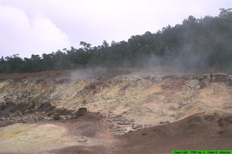
Rim Drive
goes around the rim of the main crater. The first stop is
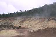
Sulphur bank. Here there is steam coming up out of the ground and in some
areas the ground has a dusting of yellow sulphur. You can smell the
fumes, but they weren't too bad. This is your first indication of how
geologically active this area still is.
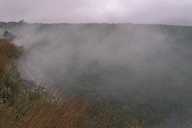
View Medium or Large image.
Steam venting from the edge of the crater.
|
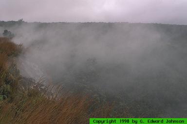
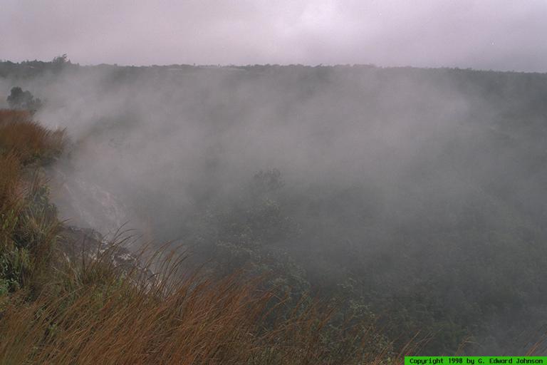
Near Sulphur bank are the steam
vents. Right at the edge of the parking lot is a small well with steam
rising from it. Rain falls in the well and the ground is hot enough to
make it turn to steam. You can feel the heat coming off the ground.
There is a short trail which takes you to the edge of the crater. The
whole edge of the crater is steaming, you can look down and see where the
trees come to an abrupt end at the edge of a old lava flow. It is just
like looking at the edge of a lake, except instead of water there is hard
black rock. The ground here is too hot for trees or shrubs to grow, so
there are only grasses. The Jagger Museum is right at the edge of the
crater, you can look out over it and see a large caldera that still has
steam rising from it. For over a hundred years, until the early 1900's,
it was a lake of molten lava, then, it rose and covered the floor of the
whole crater
for a short time then cooled. The Jagger Museum also has explanations of
how they study the volcano and artifacts they have collected. There is
even a demonstration of volcanic activity where you can affect a
seismograph by jumping up and down.
Rim Drive continues around, but we turned off and went down
Chain of Craters Road.
It meanders down to the coast, going by several older
craters and many lava flows. Since it was raining, we didn't stop at the
craters. Many of the lava flows that the road cuts through have signs
giving the date of the flow. The newer flows are nothing but black rock,
flows a little older have ferns growing in them. The oldest flows have
scrub trees. As you get lower, the rain becomes less frequent, the sun
never breaks through the clouds, but being able to get out of the car
without getting wet was a welcome change. Soon you are driving along some
cliffs by the ocean.
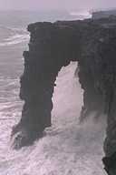
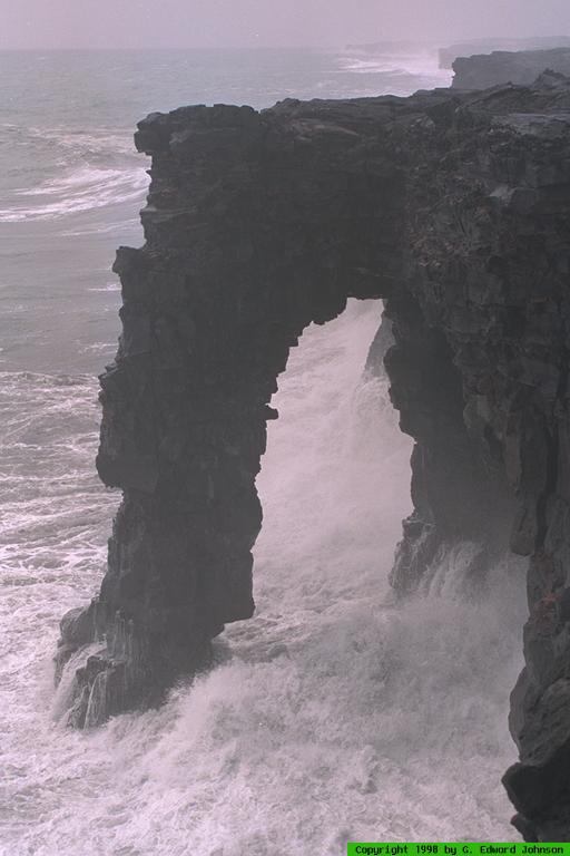
View Medium or Large image.
Natural bridge at the oceans edge.
|
There is a nice pullout where you can walk to the
edge and look down on the ocean and a natural bridge. Even though the
water is a good 20 feet below you, occasionally some spray would come up
10 feet over the cliff's edge.
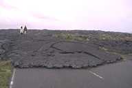
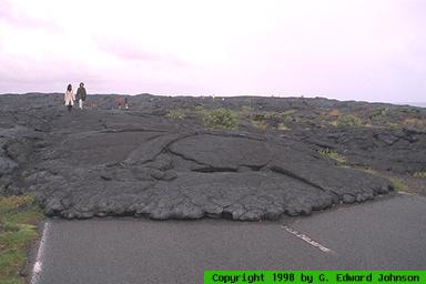
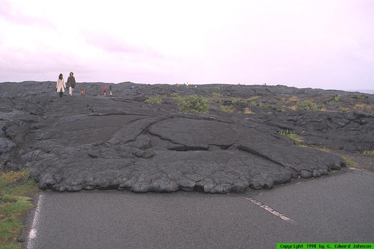
View Medium or Large image.
Lava flow crossing the road.
|
The road eventually comes to an abrupt end
where lava covered it in 1984. Since then, there has been one continuous
lava flow. About 10 miles of the road has been covered. Currently, lava
is flowing into the ocean 4-7 miles away from the end of the road. You can
just see a cloud of steam rising in the distance where it hits the ocean.
It is a long hike over unmarked land to get to the hot lava. The rangers
recommend against going, but many people do hike to the lava and stay
until dark. Be sure to take a flashlight and plenty of water with you if
you intend on doing this. You can also hike to it from the other side of
the road, outside the park. We didn't do it, so I don't know how far it
is. If you really want to see the running lava, I think a helocopter is
the easiest way. There is nothing else to do but turn around. It is an
interesting but long drive. On the way back, we stopped where the road
had been overrun by lava and they rebuilt it some distance away. There
are little bits of road left and you can still see the white line going
down the center.
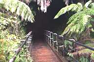
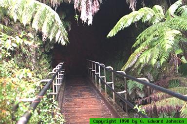
Back on Rim Drive, we stopped at
Thurston Lava Tube.
As lava flows to the ocean, the top cools and forms a
crust. Lava flows under this crust, often for a great distance. After
the lava stops flowing, the tube drains. Some of the tubes are hidden,
but others have entrances. To get to the tube you walk down a path
through a short stretch of rain forest. Giant tree ferns 20 feet tall or
more tower over you and all manner of plants grow around you. The trail
goes through the tube. Once inside, water is constantly dripping, even if
it isn't raining outside. The tube is lit while the trail goes through
it. At the end, the trail makes its way back up to the ground. The lava
tube continues and if you have a flashlight you can walk through the
unimproved tunnel. We didn't have one, so we followed the trail back to
our car.
There were a couple of places we wanted to see but
didn't because we were sick of the rain. First was Devastation trail
which is a loop that takes you through several lava flows. Second is the
rainforest near Thurston Lava Tube. There is a longer trail that runs
through it, but we were tired of getting rained on, so we headed back.
Contents |
<< Previous (day 0 - day 1) |
Current (day 2) |
Next (day 3 - day 4) >>