
| Contents: | ||
|---|---|---|
| Day 0 - Day 1 | Day 2 | Day 3 - Day 4 |
| Day 5 - Day 7 | Day 8 - Day 10 | |
| More Pictures | About | |
| Places: | ||
| Volcanoes N.P. | Rim Drive | Chain of Craters Rd. |
| Thurston Lava Tube | Akaka Falls | Mauna Loa Plantation |
| Lava Tree St. Pk. | Rainbow Falls | Pee Pee Falls |
| Boiling Pots | road to Hana | Walanapanapa St. Pk. |
| Hassagwa General Store | Haleakala N.P. | Oho'o Gulch |
| Haleakala Crater | Molokini Crater | Turtle Town |
| Kahulia-Kona | Old Airport Beach | Southpoint |
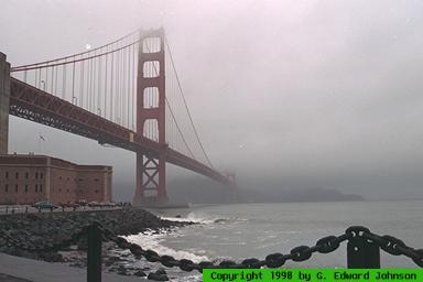
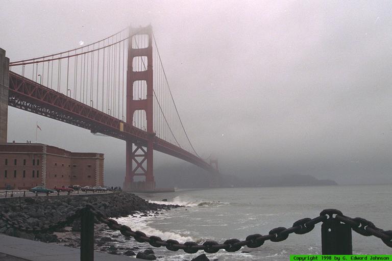
 View Medium or Large image. Golden Gate Bridge. |
Day 0 12/4
In Santa Cruz. We checked the weather in Hilo, it was raining with predictions
of more rain. Not exactly what I wanted for my vacation. As a preview
of things to come it was foggy and rainy. We drove through San Francisco
(Jen had never seen it) but there was too much fog to see much.
Day 1 12/5
We flew to Hawaii. Guess what? If you look out the window of the
airplane,you will see water. Wait a couple of hours and look again,
you'll see the same thing. Bring a book or two for entertainment (the
water gets boring).
We stop in Honolulu then land in Hilo. I really like the airports, the walkways don't have windows and in some places you walk through open air. It gets you into the tropical mood. The neat thing is, my baggage beat me to the baggage claim. I don't think that has ever happened before. Of course, it was not without incident. At Honlolulu, the inter-island terminal is quite a ways from the main terminal, and we didn't get our bags checked all the way through, so we had to pick them up and re-check them on Hawaiian Air. A word to the wise, make sure your bags get checked all the way through to your final destination. At the Hilo Airport, it rained on and off, just for about 5 minutes at a time.
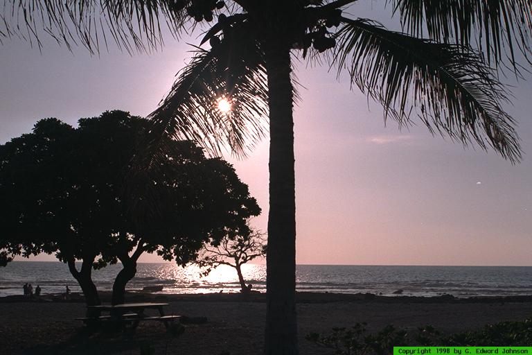
After checking in to the Hilo Hawaiian hotel, we decided to drive around town and check things out. One of the first places we stumbled across was Rainbow Falls. This waterfall is right at the edge of town, we weren't even looking for it. Unfortunately, it was dark and we couldn't see a thing. We could hear the water crashing down below us. Talk about a teaser.
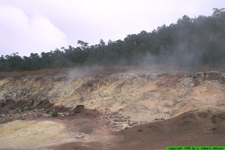
 View Medium or Large image. Sulphur Banks |
Rim Drive goes around the rim of the main crater. The first stop is Sulphur bank. Here there is steam coming up out of the ground and in some areas the ground has a dusting of yellow sulphur. You can smell the fumes, but they weren't too bad. This is your first indication of how geologically active this area still is.
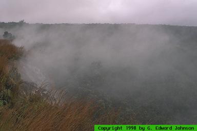
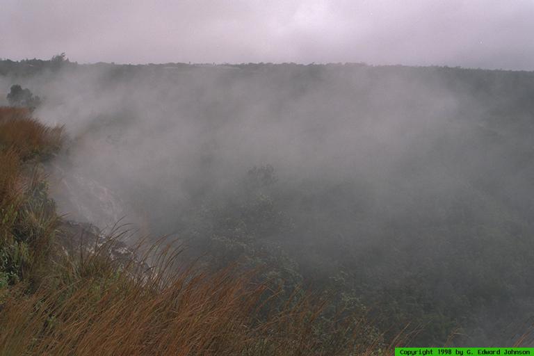
 View Medium or Large image. Steam venting from the edge of the crater. |
Rim Drive continues around, but we turned off and went down Chain of Craters Road. It meanders down to the coast, going by several older craters and many lava flows. Since it was raining, we didn't stop at the craters. Many of the lava flows that the road cuts through have signs giving the date of the flow. The newer flows are nothing but black rock, flows a little older have ferns growing in them. The oldest flows have scrub trees. As you get lower, the rain becomes less frequent, the sun never breaks through the clouds, but being able to get out of the car without getting wet was a welcome change. Soon you are driving along some cliffs by the ocean.
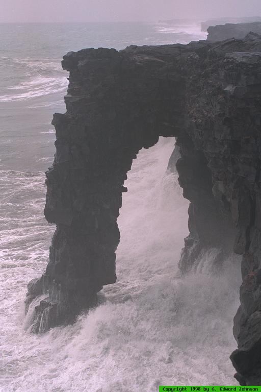
 View Medium or Large image. Natural bridge at the oceans edge. |
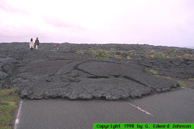
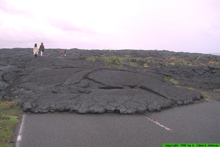
 View Medium or Large image. Lava flow crossing the road. |
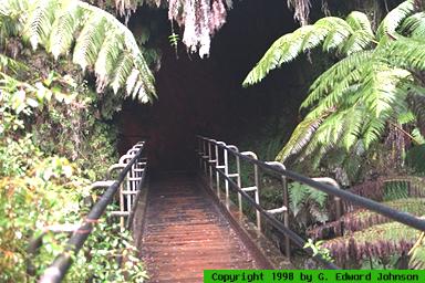
 View Medium or Large image. Thurston Lava Tube. |
Back on Rim Drive, we stopped at Thurston Lava Tube. As lava flows to the ocean, the top cools and forms a crust. Lava flows under this crust, often for a great distance. After the lava stops flowing, the tube drains. Some of the tubes are hidden, but others have entrances. To get to the tube you walk down a path through a short stretch of rain forest. Giant tree ferns 20 feet tall or more tower over you and all manner of plants grow around you. The trail goes through the tube. Once inside, water is constantly dripping, even if it isn't raining outside. The tube is lit while the trail goes through it. At the end, the trail makes its way back up to the ground. The lava tube continues and if you have a flashlight you can walk through the unimproved tunnel. We didn't have one, so we followed the trail back to our car.
There were a couple of places we wanted to see but didn't because we were sick of the rain. First was Devastation trail which is a loop that takes you through several lava flows. Second is the rainforest near Thurston Lava Tube. There is a longer trail that runs through it, but we were tired of getting rained on, so we headed back.
Day 3 12/6
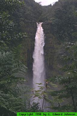
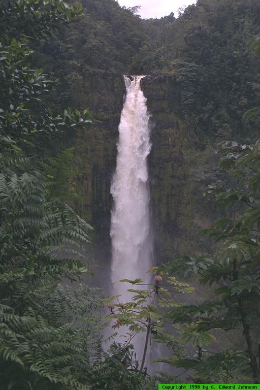
More drizzle. We drove north to Akaka Falls State Park. You have
to take a narrow road through sugar cane to get to it. There is a short
loop hike that goes by it and several others. It is more impressive if
you go toward Kahuna Falls first then around to Akaka. Akaka Falls is a
420 foot drop. It is the longest waterfall that is easily accessable in
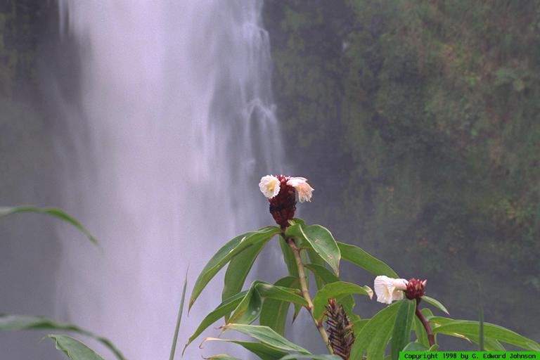
Hawaii. The lush vegetation and thick vines make for an interesting walk.
There was such a variety of flowers and a profusion of colors. There are
also stands of huge yellow bamboo. This bamboo is close to six inches in
diameter and 30 feet tall. Past Akaka Falls there are many small falls
right near the trail. Akaka Falls isn't far from Hilo and it is an easy
hike. This makes for a good afternoon jaunt.
 View Medium or Large image. Akaka Falls |
 View Medium or Large image. |
 View Medium or Large image. Small waterfall near Akaka Falls |
There are many gardens in Hawaii so if you like flowers, be sure to go to one. If you don't, it's a waste of time. We went to (Name here), 26 acres of orchids, orchards and flowers. I liked the orchard part best. It had lots of different fruit trees, macadamia, breadfruit, papaya, pineapple, banana and more. (I realize that not all of the above are fruit, or even trees, but I think you get the idea of what is there.)
The Mauna Loa plantation is nearby and was our next stop. After driving a few miles through macadamia nut trees and lanes with whimsical names, we got to the factory and visitors center. The factory was between shifts so we didn't get to see them working, but we were able to look through glass windows onto the factory floor. They also have a bus which gives a tour around the plantation. The gift shop is the main draw. They have shirts and lots of macademia products, including some you can't get other places, like macadamia nut oil. The prices are pretty good, but nuts are cheaper in the Wal*Mart in Kona.
Lava Tree State Park is a small park with an interesting reason for existing. Once, long ago, a lava flow covered a forest. Above the lava the trees burned, but below the lava there was no oxygen so they burned very slowly. When the lava receded, it left pillars of lava where the trees were. The lava cooled around the trunk, but the trunk kept burning, so these pillars are hollow. Don't go expecting too much or you'll be disappointed; its like the petrified forest in Arizona, you're not going to see trees with branches and stuff, just stumps.
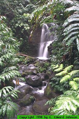
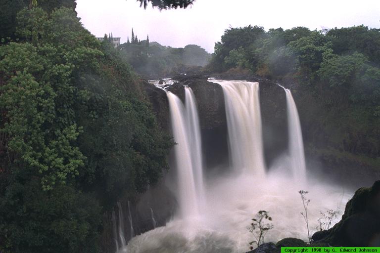
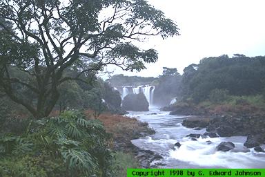
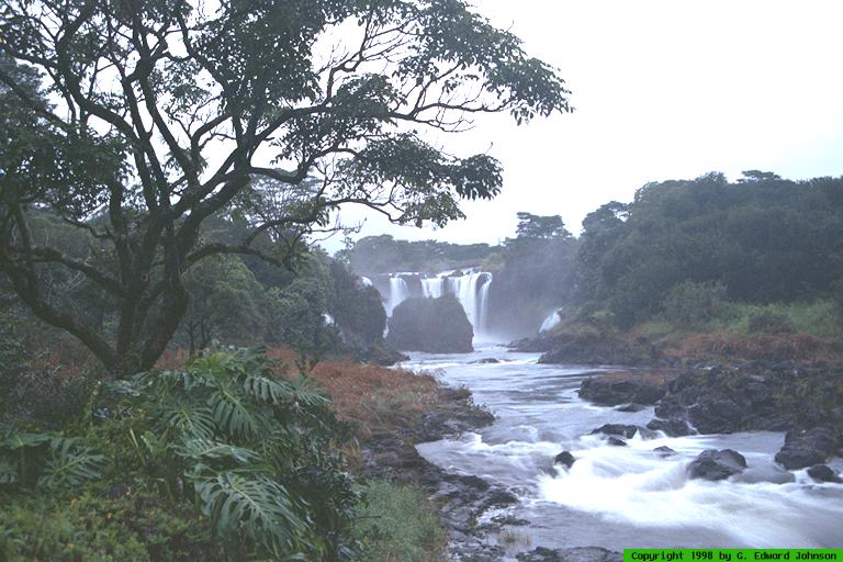
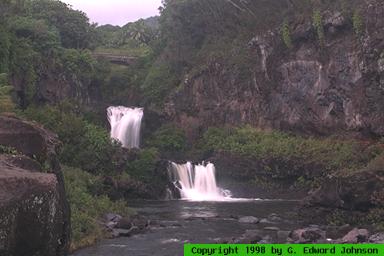
 View Medium or Large image. Rainbow Falls. |
Since we still had a bit of time we went back to Rainbow Falls. This time we got to see it. I am continually amazed at how close to Hilo this is.
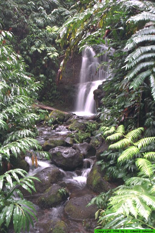
 View Medium or Large image. Pee Pee Falls. |
Day 4 12/7
For a change of scenery we flew to Kahului, Maui. We had planned
on going to our hotel right away and then the next day driving to Hana and
back. After looking closer at the map and reading a bit, we decided to
try and stay in Hana. Both of the hotels there are very expensive so we
decided to try Aloha Cottages, a much more reasonable $80 a night.
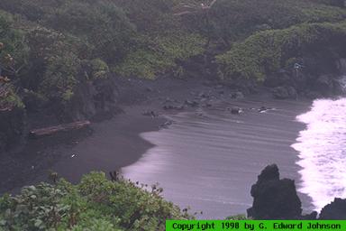
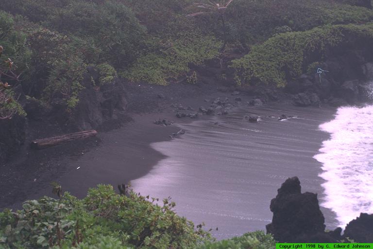
 View Medium or Large image. Black Sand Beach at Walanapanapa State Park. |
 View Medium or Large image. Ohe'o Gulch |
Day 5 12/8
Hana and beyond have been used in many movies, parts of Jurassic Park were
shot there and and Meg Ryan talks about the Seven Sacred Pools in the
movie Einstein. Everyone is quick to point out that there are more than
seven pools and they are not sacred, that is just a Hollywood thing. In
any case, they are on the eastern side of
Haleakala National Park.
Keep driving past Hana and you will get there
(with only one road that goes through Hana, you don't have to worry too
much about getting lost). First stop at Kipahulu Ranger Station and check
out the trails and weather then head toward Ohe'o Gulch. It is a
short hike to the pools. After, you can hike a couple more miles
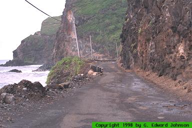
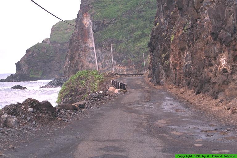
 View Medium or Large image. The road past Hana. |
Two miles past the park is the church where Charles Lindburgh is buried. You can drive up and see his grave. His wife still lives in the area. A little past the park the road gets even narrower. The yellow line down the center disappears and occasionally, the curves will have a sign telling you to honk your horn before going around. The road is in pretty bad condition and you won't be driving very fast. It does go all the way around the Island, but it turns to gravel so you aren't allowed to take your rental car on it. We turned around at the gravel and headed back, stopping at Paia for lunch. Paia has a popular wind surfing beach and is your typical yuppie antique shop and beach bum town.
Day 6 12/9
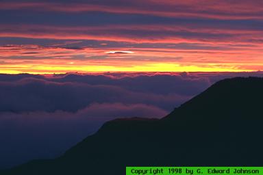
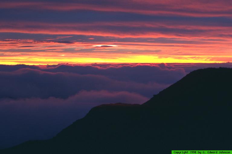
Vacation is the perfect time to get up at 3:30 am. Jen doesn't agree with
me, but East Coast time it is 8:30, which is still early for vacation. If
you want to see the sun rise at Haleakala Crater, that is when you
 View Medium or Large image. Sunrise at Haleakaia Crater. |
This was the end of the pre-planned part of the vacation, the rest we were going to spend laying on the beach on the warm side of the island. Fortunately, we were on the dry side so rain was less of a concern. After the trip we came back, took a long nap, then went to the beach to read a book. Since we had been constantly doing stuff until now, it was a nice change of pace.
Day 7 12/10
Today we slept in. We didn't have to get up until 4:30am. We went
snorkeling at Molokini Crater and Turtle Town. The tour
starts really early in the morning, and you get breakfast on the boat.
Molokini is a crescent shaped crater that sticks up out of the ocean, it
is a bird sanctuary, so you can't step on it, and you aren't allowed to
feed the fish there. You will see lots of coral, fish, and midnight blue
sea urchins. The water is pretty warm, so don't worry about freezing.
After snorkeling for about 45 minutes we were tired and got back on the
boat and went to Turtle Town. Green Sea Turtles live there. They used to
be endangered but are staging a comeback and now are only protected. You
can't touch them, but you can feed the fish there. Pull out the fish food
and you will be mobbed by hundreds of colorful fish. You are much more
bouyant in salt water so you can just can put your head in the water,
breath through the snorkel and float, without treading water. Two hours
of snorkeling doesn't seem like much time but you will be tired by the end
of it. After Turtle Town, we headed back to the dock and ate lunch and
had drinks on the way back.
Before going back to the hotel we stopped by the Hard Rock Cafe for drinks and to get souveniers. We also stopped at a store specializing in gecko merchandise that had the floor covered in sand (on purpose).
For dinner we went to a Polynesian Luau. A Polynesian Luau is diferent from a Hawaiian Luau because they give you a shell lea instead of a flower one. Good food and a pit cooked pig, with dances from different areas of Polynesia and Hawaii. We even learned to hula.
At this time, you have to mention Poi. It is a traditional hawaiian dish made of pounded taro root. Sooner will hear you went to Hawaii and ask if you have poi. If you listen closely, you can usually hear them chuckle to themselves when they say it. If you were ever in kindergarden and ate paste, you know poi. It has the same consistency and taste as paste, but it isn't quite as salty. Of course, you can add salt and take a trip down memory lane.
Day 8 12/11
We flew back to the Big Island, but before that, we took a helicopter tour
of the island. The main draw is the Hana area, and if you don't drive
there, the helicopter is a great way to see it, otherwise it is an
interesting, but expensive, trip. The tour took an hour and we went all
the way around the island; there are other, shorter trips that go to
specific parts.
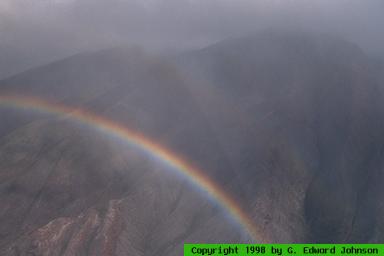
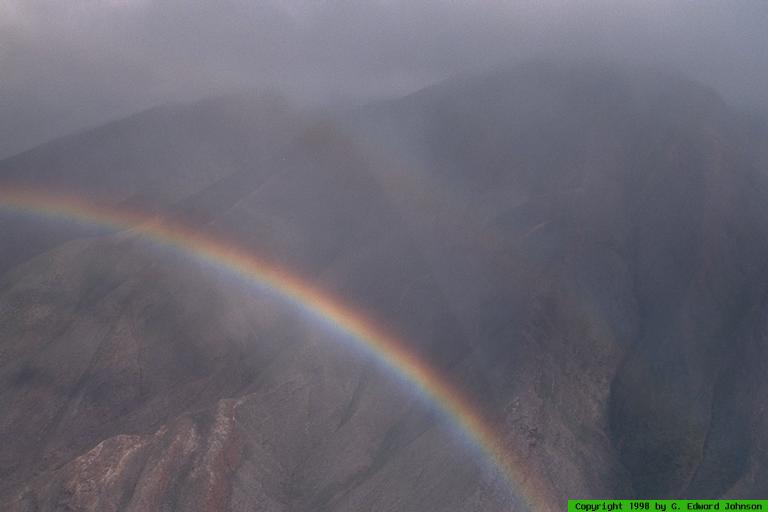
 View Medium or Large image. Rainbow over the mountains. |
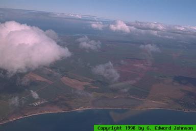
 View Medium or Large image. The narrow part of Maui. |
Maui is made of two volcanos, one on each side of the island. Between them is a narrow bit of flat land that was formed when the lava flows from one volcano met the ones from the other volcano. You can tell its narrow by looking on the map, but from a helicopter, you can see just how narrow it is.
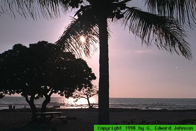
 View Medium or Large image. Sunset at Old Airport Beach. |
Day 9 12/12
The last couple of days we spent in Kahulia-Kona. Nothing planned,
just hanging out, doing some shopping, spending time on the beach. Most
of the Kona coast is rocky, so finding a good beach is hard. We went to
White Sands beach (the sand is normal brownish-grey, not white) which was
small and crowded. There were lots of little shops that have interesting
stuff. I was looking for christmas presents or I would have been bored
after an hour. We also went to the Old Airport Beach north of
town. This is a long stretch of mixed areas of sand and rock. I would
recommend skipping the other beaches and going to this one instead if you
find yourself in Kona. Quite a few local kids hang out there and the area
has a wide paved airstrip, so I bet there is some drag racing there after
dark.
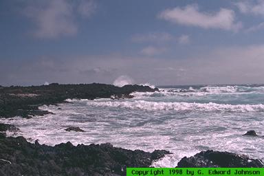
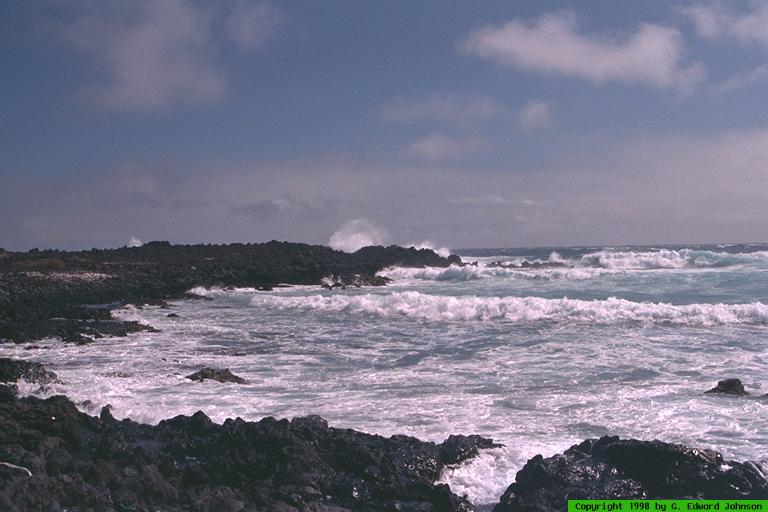
 View Medium or Large image. Southpoint. |
Day 10 12/13
Our last day in Hawaii. We had almost a full day with nothing to do so we
decided to drive to Southpoint. In case you are ever on Jeopardy! keep in
mind Southpoint is the southernmost part of the U.S. This is
really its only claim to fame.
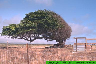
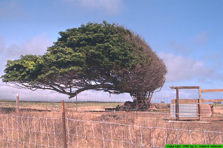
 View Medium or Large image. Windblown tree. |
Time for the long, long trip home. We left the big Island at 5pm, flew to Honolulu, stayed there until 8pm (Hawaii time). The trip back to the mainland was long, I slept during most of it. We landed in Dallas-Ft. Worth at 7am (Texas time) then finally got into Baltimore at noon (Eastern time).