Natural Bridges National Monument is located in south-central Utah. There are three natural bridges in the park, all along the same canyon. A scenic drive loops through the park and there are overlooks for all the bridges. You can also hike down to each of them or take a long loop trail that goes through the canyon and by all three.
I had to think twice before putting Natural Bridges on my itinerary. Aside from knowing that it was a small park with only three bridges, I knew little about it or the bridges. I went and it made a good day trip. I hiked to the base of all three bridges. One hike was fairly short but the other two were strenuous 1.5 mile hikes. One dropped 400 feet and another 500 feet. The bridges are huge, hundreds of feet across and high. It had rained several days earlier and there was still a trickle of water going underneath them.
The park ranges from 5,500 feet to 6,500 feet above sea level. The top of the canyon is covered with a Pinyon-juniper forest at higher elevations and grass and shrubs at lower elevations. In the canyons, where there is more water, cottonwood and willow trees grow along the stream banks.
To view a picture, click on the thumbnail image or its description.
Images Copyright 2003, G. Edward Johnson
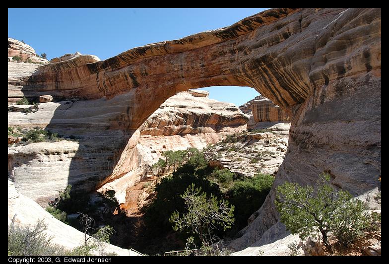 Sipapu Bridge
The first bridge on the drive is Sipapu bridge. It is 220 feet high and has
a span of 268 feet. It is the largest bridge in the park.
Date: September 15, 2003
Location: Sipapu Bridge, Natural Bridges N.M., UT
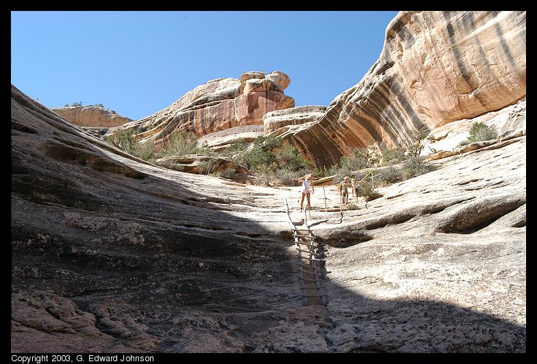 Hikers on the trail
A group of hikers looking at the ladder they have to climb down to get to
the bottom of the bridge.
Date: September 15, 2003
Location: Sipapu Bridge, Natural Bridges N.M., UT
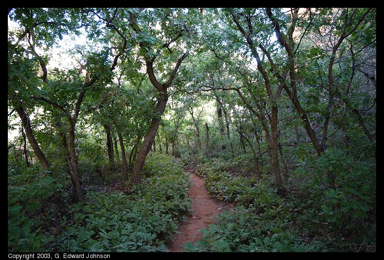 Trees under the bridge
You wouldn't expect such a lush environment, but under the bridge there
is much more water.
Date: September 15, 2003
Location: Sipapu Bridge, Natural Bridges N.M., UT
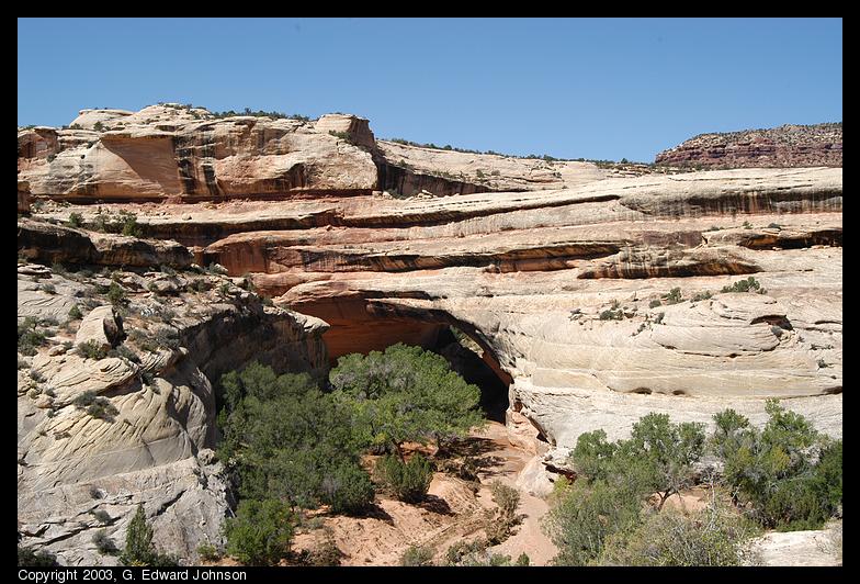 View of Kachina Bridge
Due to the angle of this bridge, it is hard to see from the road and you
don't get a good view of it untill you are almost to the bottom of the
trail. It is 210 feet high and has
a span of 204 feet. It is the thickest bridge in the park.
Date: September 15, 2003
Location: Kachina Bridge, Natural Bridges N.M., UT
 Kachina Bridge from the base
Towards the end of the trail, it follows a wash that joins the main
stream right at the bridge.
Date: September 15, 2003
Location: Kachina Bridge, Natural Bridges N.M., UT
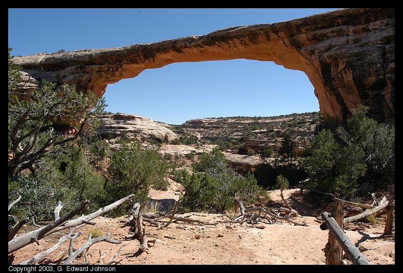 Owachomo bridge and trail
Owachomo bridge is both the narrowest and thinest of the bridges. In
some places it is only 9 feet thick. It has a hight of 106 feet and a
span of 180 feet.
Date: September 15, 2003
Location: Owachomo Bridge, Natural Bridges N.M., UT
 The side of Owachomo bridge
At the side of the bridge you can see how it curves down sharpley,
rapidly becoming thicker.
Date: September 15, 2003
Location: Owachomo Bridge, Natural Bridges N.M., UT
Copyright 1995-2004, G. Edward Johnson. All rights reserved.